
Published
Machine-learning-based two-dimensional building exposure assessment to rainfall-triggered landslides in the South Sikkim Himalaya
Published in July-Dec 2026 (Vol. 1, Issue 1, 2026)
Keywords
Abstract
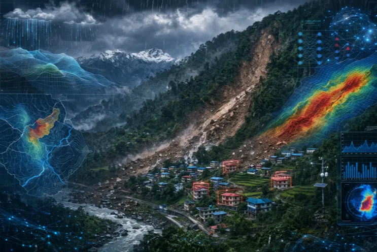
Landslide risk in the Sikkim Himalaya is increasingly shaped by the building stock accumulating on steep, weathered slopes, yet quantitative information on the exposure of buildings to rainfall-triggered slope failure remains scarce at the settlement scale. This study couples a Random Forest (RF) landslide susceptibility model with a settlement-scale building inventory to quantify building exposure in South Sikkim, Indian Himalaya. Ten conditioning factors—slope, aspect, curvature, distance to rivers, distance to roads, distance to lineaments, Topographic Wetness Index (TWI), Land Use/Land Cover (LULC), Normalized Difference Vegetation Index (NDVI) and Stream Power Index (SPI)—were combined with a multi-source landslide inventory to train the classifier and produce a five-class susceptibility surface, which was then intersected with the building layer. The RF model attained an Area Under the Receiver Operating Characteristic Curve (AUC) of 0.802, indicating good discriminative capability. High-susceptibility zones cover approximately 24% of the study area but contain 38% of the buildings, revealing a systematic over-representation of the built environment in the most hazardous terrain and a strong potential for cascading disruption of settlement services. The framework is data-parsimonious, reproducible, and directly transferable to comparable Himalayan settlements, providing an operational basis for hazard-informed regulation of new construction and for integrating exposure into landslide risk reduction in mountain regions.
References
- [1]Adnan, M. S. G., Rahman, S., Ahmed, N., Ahmed, B., Rabbi, M. F., & Rahman, R. M. (2020). Improving Spatial Agreement in Machine Learning-Based Landslide Susceptibility Mapping. Remote Sensing, 12(20), 3347. https://doi.org/10.3390/rs12203347
- [2]Ageenko, A., Hansen, L. C., Lyng, K. L., Bodum, L., & Arsanjani, J. J. (2022). Landslide Susceptibility Mapping Using Machine Learning: A Danish Case Study. ISPRS International Journal of Geo-Information, 11(6), 324. https://doi.org/10.3390/ijgi11060324
- [3]Bansal, B. K., Verma, M., Gupta, A. K., & Prasath, R. A. (2022). On mitigation of earthquake and landslide hazards in the eastern Himalayan region. Natural Hazards, 114(2), 1079–1102. https://doi.org/10.1007/s11069-022-05448-y
- [4]Beigh, I. H., & Bukhari, S. K. (2024). Landslide susceptibility assessment using GIS-based multicriteria decision analysis (MCDA) along a part of National Highway-1, Kashmir-Himalayas, India. Applied Geomatics, 16(2), 451–469. https://doi.org/10.1007/s12518-024-00559-6
- [5]Bhasin, R., Aslan, G., & Dehls, J. (2023). Ground Investigations and Detection and Monitoring of Landslides Using SAR Interferometry in Gangtok, Sikkim Himalaya. Geohazards, 4(1), 25–39. https://doi.org/10.3390/geohazards4010003
- [6]Chen, T. K., Kincey, M., Rosser, N., & Seto, K. C. (2024). Identifying recurrent and persistent landslides using satellite imagery and deep learning: A 30-year analysis of the Himalaya. Science of the Total Environment, 922, 171161. https://doi.org/10.1016/j.scitotenv.2024.171161
- [7]Chen, C., Shen, Z., Weng, Y., You, S., Lin, J., Li, S., & Wang, K. (2023). Modeling Landslide Susceptibility in Forest-Covered Areas in Lin’an, China, Using Logistic Regression, a Decision Tree, and Random Forests. Remote Sensing, 15(18), 4378. https://doi.org/10.3390/rs15184378
- [8]Das, J., Saha, P., Mitra, R., Alam, A., & Kamruzzaman, M. (2023). GIS-based data-driven bivariate statistical models for landslide susceptibility prediction in Upper Tista Basin, India. Heliyon, 9(5), e16186. https://doi.org/10.1016/j.heliyon.2023.e16186
- [9]Das, M. R., Gautam, G. K., Jain, S., Bhat, M. F., Mankar, A. K., & Koner, R. (2026). A comparative analysis of AHP, FR, AHP-FR and LR models for landslide susceptibility mapping in Sikkim Himalaya, India. Earth Surface Processes and Landforms, 51(2). https://doi.org/10.1002/esp.70257
- [10]Dikshit, A., Sarkar, R., Pradhan, B., Segoni, S., & Alamri, A. (2020). Rainfall Induced Landslide Studies in Indian Himalayan Region: A Critical Review. Applied Sciences, 10(7), 2466. https://doi.org/10.3390/app10072466
- [11]Dubey, S., Sattar, A., Goyal, M. K., Allen, S., Frey, H., Haritashya, U. K., & Huggel, C. (2023). Mass Movement Hazard and Exposure in the Himalaya. Earth's Future, 11(9). https://doi.org/10.1029/2022EF003253
- [12]Dwivedi, M. K., & Jain, K. (2025). Unveiling the layers of decision-making in landslide susceptibility: A critical exploration of multi-criteria analysis, bivariate statistics, and knowledge-based approaches for complex relationships of factors and their weightage. https://doi.org/10.21203/rs.3.rs-6750285/v1
- [13]Kalantar, B., Ueda, N., Saeidi, V., Ahmadi, K., Halin, A. A., & Shabani, F. (2020). Landslide Susceptibility Mapping: Machine and Ensemble Learning Based on Remote Sensing Big Data. Remote Sensing, 12(11), 1737. https://doi.org/10.3390/rs12111737
- [14]Kato, T., Rambali, M., & Blanco, V. M. F. (2021). Strengthening climate resilience in mountainous areas. https://doi.org/10.1787/1af319f0-en
- [15]KC, D., Dangi, H., & Hu, L. (2022). Assessing Landslide Susceptibility in the Northern Stretch of Arun Tectonic Window, Nepal. CivilEng, 3(2), 525–540. https://doi.org/10.3390/civileng3020031
- [16]Kincey, M., Rosser, N., Swirad, Z., Robinson, T., Shrestha, R., Pujara, D. S., Basyal, G. K., Densmore, A. L., Arrell, K., Oven, K., & Dunant, A. (2024). National-Scale Rainfall-Triggered Landslide Susceptibility and Exposure in Nepal. Earth's Future, 12(2). https://doi.org/10.1029/2023EF004102
- [17]Koley, B., Nath, A., Saraswati, S., Bandyopadhyay, K., & Ray, J. K. (2019). Assessment of Rainfall Thresholds for Rain-Induced Landslide Activity in North Sikkim Road Corridor in Sikkim Himalaya, India. Journal of Geography, Environment and Earth Science International, 1–14. https://doi.org/10.9734/jgeesi/2019/v19i330086
- [18]Krishna, A. P. (2025). Sikkim Glacial Lake Outburst Flood (GLOF) Disaster of 2023: Geoinformatics-Based Assessment of Causes and Impact. https://doi.org/10.21203/rs.3.rs-7405556/v1
- [19]Kumar, A., Asthana, A. K. L., Priyanka, R. S., Jayangondaperumal, R., Gupta, A. K., & Bhakuni, S. S. (2017). Assessment of landslide hazards induced by extreme rainfall event in Jammu and Kashmir Himalaya, northwest India. Geomorphology, 284, 72–87. https://doi.org/10.1016/j.geomorph.2017.01.003
- [20]Laha, C., Chattoraj, S., Prasain, G. P., & Sharma, P. (2024). Risk Resilience of Growing Settlements in Landslide Prone Hilly Areas: Case Study on Kalimpong-I Block, Darjeeling District, West Bengal. https://doi.org/10.21203/rs.3.rs-3676394/v1
- [21]Meena, S. R., Puliero, S., Bhuyan, K., Floris, M., & Catani, F. (2022). Assessing the importance of conditioning factor selection in landslide susceptibility for the province of Belluno (Region of Veneto, northeastern Italy). Natural Hazards and Earth System Sciences, 22(4), 1395–1417. https://doi.org/10.5194/nhess-22-1395-2022
- [22]Naik, D. D., & Palakuzhiyil, Y. (2024). Landslide Susceptibility Mapping using Geospatial Framework: A Study of Pinder Basin, Chamoli District, Uttarakhand, India. https://doi.org/10.21203/rs.3.rs-4006670/v1
- [23]Nawazuzzoha, M., Rashid, M. M., Iqbal, F., Suheb, Shakeel, A., Arabameri, A., & Naqvi, H. R. (2025). Advanced Machine Learning Models for Landslide Susceptibility Mapping in South Sikkim Himalayas, India. Geological Journal, 61(2), 371–387. https://doi.org/10.1002/gj.5234
- [24]Nhu, V., Shirzadi, A., Shahabi, H., Chen, W., Clague, J. J., Geertsema, M., Jaafari, A., Avand, M., Miraki, S., Asl, D. T., Pham, B. T., Ahmad, B. B., & Lee, S. (2020). Shallow Landslide Susceptibility Mapping by Random Forest Base Classifier and Its Ensembles in a Semi-Arid Region of Iran. Forests, 11(4), 421. https://doi.org/10.3390/f11040421
- [25]Nnanwuba, U. E., Qin, S., Adeyeye, O. A., Cosmas, N. C., Yao, J., Qiao, S., & Egwuonwu, E. M. (2022). Prediction of Spatial Likelihood of Shallow Landslide Using GIS-Based Machine Learning in Awgu, Southeast Nigeria. Sustainability, 14(19), 12000. https://doi.org/10.3390/su141912000
- [26]Pandey, B. W., & Prasad, A. S. (2018). Slope vulnerability, mass wasting and hydrological hazards in Himalaya: A case study of Alaknanda Basin, Uttarakhand. Terrae Didatica, 14(4), 395–404. https://doi.org/10.20396/td.v14i4.8654111
- [27]Pourghasemi, H. R., Kariminejad, N., Amiri, M., Edalat, M., Zarafshar, M., Blaschke, T., & Cerdà, A. (2020). Assessing and mapping multi-hazard risk susceptibility using a machine learning technique. Scientific Reports, 10(1). https://doi.org/10.1038/s41598-020-60191-3
- [28]Rabby, Y. W., Li, Y., & Hilafu, H. (2023). An objective absence data sampling method for landslide susceptibility mapping. Scientific Reports, 13(1). https://doi.org/10.1038/s41598-023-28991-5
- [29]Rafique, M. F., & Joshi, V. (2024). Information Value Model Based Mapping of Updated Spatial and Temporal Landslide Susceptibility: A Case Study from East Sikkim District, India’s Northeastern Himalayas. https://doi.org/10.20944/preprints202404.0066.v1
- [30]Rajamani, S. K., & Iyer, R. S. (2024). The Phenomenon of Eco-Anxiety and Distress Related to Climate Change and Environmental Degradation. (pp. 156–177). https://doi.org/10.4018/979-8-3693-2177-5.ch011
- [31]Roy, S. K., Dey, S., Das, J., Hossen, B., Das, S., Hasan, M. M., & Mojumder, P. (2025). Utilising Machine Learning Approaches for Enhanced Landslide Susceptibility Mapping in Sikkim, India. Geological Journal, 60(5), 1150–1169. https://doi.org/10.1002/gj.5198
- [32]Saha, S., Roy, J., Hembram, T. K., Pradhan, B., Dikshit, A., Maulud, K. N. A., & Alamri, A. (2021). Comparison between Deep Learning and Tree-Based Machine Learning Approaches for Landslide Susceptibility Mapping. Water, 13(19), 2664. https://doi.org/10.3390/w13192664
- [33]Sarkar, S., & Saha, K. (2026). Evaluating the influence of anthropogenic hillslope modulation in relation to shallow landslides in the Rishikhola region, Darjeeling–Sikkim Himalaya, India. Scientific Reports, 16(1). https://doi.org/10.1038/s41598-025-30543-y
- [34]Sattar, A., Cook, K., Kant, S., Berthier, É., Allen, S., Rinzin, S., de Vries, M. V. W., Haeberli, W., Kushwaha, P., Shugar, D. H., Emmer, A., Haritashya, U. K., Frey, H., Gurudin, K. S. K., Rajak, R., Hossain, F., Huggel, C., Mergili, M., Azam, M. F., … Bhat, S. Y. (2025). The Sikkim flood of October 2023: Drivers, causes, and impacts of a multihazard cascade. Science, 387(6740). https://doi.org/10.1126/science.ads2659
- [35]Shahi, Y. B., Kadel, S., Dangi, H., Adhikari, G. P., KC, D., & Paudyal, K. R. (2022). Geological Exploration, Landslide Characterization and Susceptibility Mapping at the Boundary between Two Crystalline Bodies in Jajarkot, Nepal. Geotechnics, 2(4), 1059–1083. https://doi.org/10.3390/geotechnics2040050
- [36]Sharma, A., Schwartz, S. M., & Méndez, E. (2013). Hospital volume is associated with survival but not multimodality therapy in Medicare patients with advanced head and neck cancer. Cancer, 119(10), 1845–1852. https://doi.org/10.1002/cncr.27976
- [37]SP., D., Das, J., R., J., TM., S., V., S., & RS., L. (2026). Integrating Geo-Environmental Factors and Ensemble Machine Learning for Landslide Susceptibility Assessment in Kodaikanal and its Environs, India. https://doi.org/10.21203/rs.3.rs-8113160/v1
- [38]Ullah, M., Tang, B., Huangfu, W., Yang, D., Wei, Y., & Qiu, H. (2024). Machine Learning-Driven Landslide Susceptibility Mapping in the Himalayan China–Pakistan Economic Corridor Region. Land, 13(7), 1011. https://doi.org/10.3390/land13071011
- [39]Uniyal, A. (2010). Disaster management strategy for potential slide zones of Kumarkhera in Narendra Nagar township of Tehri Garhwal district, Uttarakhand, India. Disaster Prevention and Management: An International Journal, 19(3), 358–369. https://doi.org/10.1108/09653561011052529
- [40]Yadav, P., & Kumar, S. (2023). Causes, impacts & mitigation measures for flash floods in Indian Himalayan region. International Journal of Scientific Research in Engineering and Management, 7(4). https://doi.org/10.55041/ijsrem19803
- [41]Zimik, H. V., Angchuk, T., Misra, A. K., Ranjan, R. K., Wanjari, N., & Basnett, S. (2022). GIS-based identification of potential watershed recharge zones using analytic hierarchy process in Sikkim Himalayan region. Applied Water Science, 12(11). https://doi.org/10.1007/s13201-022-01758-5
Authors (1)
Shivam Priyadarshi
Central University of South Bi...Central University of South BiharCentral University of South BiharCentral University of South Bihar
View all publications →Download Article
Summarise this paper with AI:
Article Information
Published in:
July-Dec 2026 (Vol. 1, Issue 1, 2026)Article Impact
Views:1,040
Downloads:2,241
How to Cite
Priyadarshi, S. (2026). Machine-learning-based two-dimensional building exposure assessment to rainfall-triggered landslides in the South Sikkim Himalaya. Geographical Studies and Development, 1(1), 1-22. https://geographicalstudies.com/articles/GSD110002
Article Actions
More from this Issue
Geographical Indication Tag for Mithila Makhana and Its Prospects for Development in North Bihar, India
SK Amirul Islam, Aktar Hu...Read more →
Understanding the Level of Job Satisfaction among the Workers of Tea-processing Units based on Structural Equation Modelling (SEM): A Case Study of Rajganj Block, Jalpaiguri District, West Bengal
Suity Ghosh, (Dr.) Ranjan...Read more →
Internal Migration in Sikkim: Patterns, Trends and Causal Factors
Sohel Firdos, Asmita Adhi...Read more →